![]()
Brief Overview:
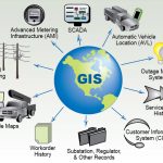
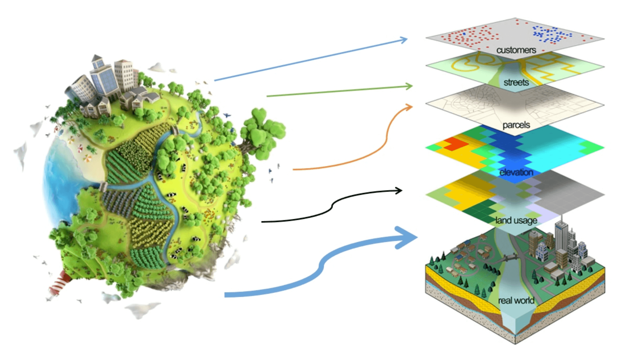
This course covers the foundational concepts and techniques used in geographic information systems (GIS) for spatial data analysis and digital mapping.
Course Objectives:
It aims to provide participants with a basic understanding of digital geography and how to use GIS software for data input, analysis, and map production.
Training Content:
Topics include:
- An introduction to GIS.
- Basics of spatial data analysis.
- Practical use of software like ArcGIS or QGIS.
- Performing spatial analysis and visualization.
Target Audience:
The course is suitable for students and graduates in geography, environmental studies, civil engineering, road engineering, and anyone working in fields involving spatial data analysis and map design.