![]()
Brief Overview:
An advanced GIS course focuses on teaching participants advanced methods and techniques for geographic data analysis and map design using GIS software.
Course Objectives:
The course aims to enhance spatial analysis skills, geographical modeling, and proficiency in using GIS software tools to create advanced maps and conduct precise analyses.
Training Content:
Expected content includes:
- Case studies.
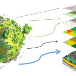
- Remote sensing techniques.
- Applications of GIS in fields such as:
- Urban planning.
- Natural resource management.
- Environmental analysis.
- Three-dimensional modeling techniques.
Target Audience:
This course is suitable for road engineers, surveyors, geophysicists, urban planners, and anyone working in geographic data fields seeking to advance their skills in GIS.